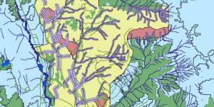
In this first map, shown here: EIA, we assess the proposed project boundary for the ski resort in terms of its overlap with old growth forest and ungulate winter habitat.
In this second map, shown here: EIA3D, we show a 3D elevation model for the project area and show the snow line contour.
Based on the results of this analysis, this memo: GaribaldiAtSquamishMemo, was created to outline the potential impact of the project in its current form and provide recommendations for whether or not it should proceed.