GEOB 270 Professional Development Reflection
My final reflection on the GEOB 270: Geographic Information Science course
ubcarts.ca portfolio
Computer-based graphical methods of data input and analysis. Emphasis on data visualization techniques such as cartographic modelling and exploratory data analysis.

My final reflection on the GEOB 270: Geographic Information Science course
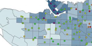
This project was focused of determining which areas of Vancouver are at greatest risk for a measles outbreak
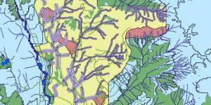
This analysis conducted an environmental impact assessment of the Garibaldi at Squamish Ski Resort
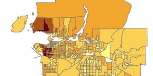
This analysis used census data to compare housing costs and affordability between Vancouver and Montreal
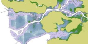
This geographic analysis assesses the risk of storm surges in Vancouver and attempts to show which areas of the city would be the most impacted.